Search Flights from Casablanca to Manila
Cheapest flights from Casablanca to Manila
Estimated Prices for Casablanca to Manila Flights
| Popular Airport | Ninoy Aquino Intl. Airport |
|---|---|
| Popular Airlines | |
| Approximate Flight Duration | 18 hour 55 min |
| Approximate Travel Distance | 12378 Km |
Key Features of the Airlines

- Star Alliance Member
- Complimentary Meals
- 2x23kg Baggage

- Best LCC Middle East
- Flexible Rebooking
- Wide Domestic Network

- Egypt-KSA Specialist
- 30kg Free Baggage
- Full Service Included

- Lowest Fares
- Hajj & Umrah Specialist
- Easy Mobile Booking

- Full Service with Meals
- 23kg Free Baggage
- SkyTeam Member
Information compiled by AI. For the most up-to-date information, contact the airline.
Transportation to Airport from Casablanca City Center
Mohammed V Intl. Airport
Train
The most commonly used transportation vehicle used for travelling to the airport from Casablanca city center is train. You can reach Mohammed V Airport in about 35-40 minutes thanks to the trains that you can get on from the station located in the city center. You can buy your ticket online or from the ticket office located at the station.
Taxi
Passengers who want to reach Mohammed V Airport in a comfortable and fast way should prefer taxis. Due to the distance between the airport and city center, the cost of this travel is about 250-400 Dirham. In order not to have any problem about the fare, you can agree on the fare before getting on the taxi.
Hotel Shuttle
Since there aren’t many alternatives for travelling to the airport from Casablanca city center, airport transfers offered by many hotels make this travel easier for visitors. Many hotels offer airport shuttle service for their guests. You can benefit from this service by getting in contact with your hotel and make a reservation in advance.
Car Rental
You can reach Mohammed V Airport from the city center without losing time by renting a car. You can get information about the cost of renting a car by contacting one of the car rental offices in the city center. Those who don’t want to lose time with other means of transportation can rent a car for travelling to the airport from the city center.
Airport Information
The distance between the city center and Mohammed V Airport is about 30-40 minutes. Mohammed V Airport is one of the commonly used airports for international flights in the country. The airport which is home to many domestic and international visitors for many years can be reached by taxi, train or renting a car.
Transportation to Manila City Center from Airport
Ninoy Aquino Intl. Airport
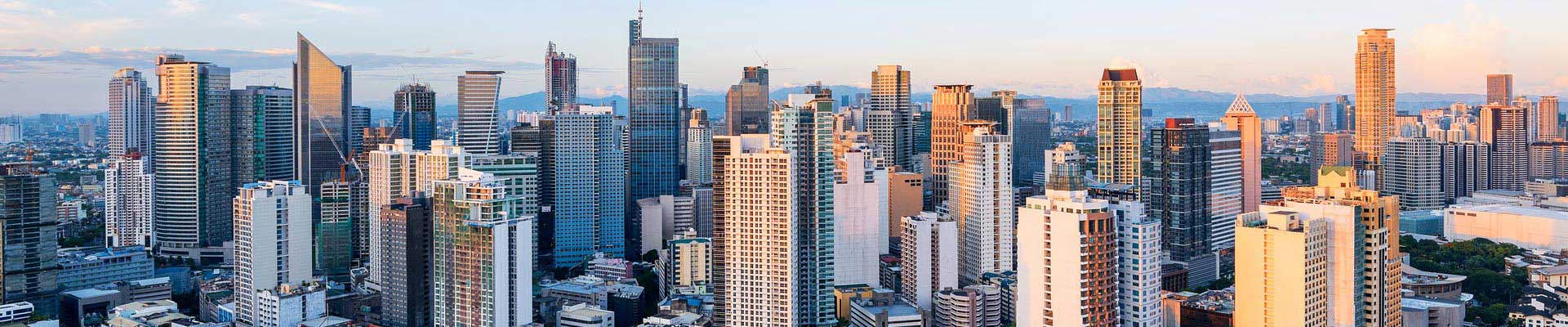
Known as the biggest city in the Philippines, Manila is a metropolis in the Metro Manila region that is composed of many different provinces. Malate, one of the sixteen towns that make up Manila, hosts hotels. While Ermita is the most frequent destination for tourists and entertainment, Intramuros is the historical part of the city. San Miguel and Sampaloc are university districts, while Paco is the capital of the working class. Manila, known as the heart of the education, business and transportation in the Philippines, is a delightful choice for tourists with its forests and for its spectacular islands. Ninoy Aquino International Airport welcomes travelers who want to visit this city.
In Manila, the most common vehicles used in urban transportation are the rail system and the bus. In addition, besides these most frequently used means of urban transportation, other older means of transportation such as phaetons, three-wheeled vehicles and mini-buses are also used. When you use public transport in the city, you can take advantage of single use tickets, or the special tickets that you can load money on. We advise you to buy these special tickets, especially if you travel frequently, so that you can save time avoiding the long ques to buy ticket every time.
Most means of public transportation does not depart in time, so we advise you not to rely on the schedules. The public transport is mostly very cramped and full. For this reason, we recommend that you protect your valuables during your travels. You can also use taxis and bicycles and phaetons that serve as taxis to travel faster and practically.
Since the city's main attractions are close to each other, it is possible to walk. In addition, there are ferryboats within the city that can be reached from many ports in the Port Area near the Pasig River. If you want to travel to neighboring cities, you can also take advantage of intercity bus and train services. One of the biggest problems of Ninoy Aquino International Airport is that the inter-terminal transportation is not very strong. Unlike many airports, you cannot reach the terminals of the airport, which has four terminals, on foot.
To travel between the terminals you need to get buses and jeepneys, and pass through crowded streets. While Terminal 1 is used for international flights, Terminal 2 serves to flights of Philippine Airlines. Terminal 3 hosts domestic flights, while Terminal 4 hosts eligible flights and international flights rarely.
Bus
Buses depart from the immediate exit of the arriving passenger section and take the passengers to many parts of the city. In some cases, you may need to transfer to a train, based on your destination. At some times the buses can be very crowded. Under normal conditions, different buses operate to different parts of the city; but some buses can change their route at certain times and travel through many parts of the city. These buses are going to Manila, as well as to the cities of Makati and Quezon. Besides, buses are among the frequently preferred options for urban transport.
The bus lines offer an important public transport alternative, which is used to reach to the points where the train lines do not reach, serving the whole city.
Jeepney
Land vehicles, which are called Jeepneys in the Philippines, can carry a large number of passengers and they are used as minibuses. Jeepneys, which are usually very crowded, are the most popular public transport services in the country. These have gained a traditional iconic character with their special decoration. You can use Jeepneys to reach many of the places you want to go in town. You can easily find Jeepneys near buses at the airport exit. These vehicles provide transportation services from the airport to many parts of the city, just in the case of buses.
Train (Light Rail System)
Train is a cheap, fast and practical means of public transport that is not affected by the traffic jam,. Nevertheless, it is necessary to remind that trains are as crowded as all other means of public transport. Trains, known as LRT (Light Rail Transit System), travel throughout the entire Metro Manila region, including Manila. Although it uses a light rail system, the infrastructure is quite similar to that of metro. The train lines do not provide a direct service to the airport.
But you can transfer to these train lines from most buses and jeepneys coming from the airport. There are two different train lines in the light rail system. The green line, LRT 1, starts at Baclaran Station, in the southernmost part of city, and travels up to the Roosevelt Station, in the north of the city, following the road by the Manila Bay, in the west of the city. The blue line, LRT 2, runs parallel to the Pasig River, traveling to west from the east. This line provides transfer opportunity to green LRT and yellow MRT (metro) lines.
Metro
Metro, just like train, does not provide a direct transport service to the airport. It is possible to transfer to the trains from buses and jeepneys departing from the airport. The Metro, known as the MRT (Metro Rail Transit System), operates similarly to the light rail system. The MRT line is known as the third (yellow) line. With this line, you can transfer to LRT 1 line at Roosevelt Station. This line connects to Taft Avenue Station, the southern tip of the green line, on the southernmost part of the city, starting from the North Avenue Station, which is the first stop after the transfer, and continuing to the south of the city in the east direction. In short, it is possible to say that LRT and MRT lines draw a circle around the city, being connected from the very center of this circle.
Railcar
PNR (Philippine National Railways), the orange line, is operating on the heavy rail system with a single carriage engine, called railcar. These vehicles depart every half an hour and are usually preferred for transportation between neighboring cities in Metro Manila region.
Taxi
The most comfortable option to get to the city from the airport is, of course, taxi. However, taxi fares are much higher compared to public transport. The airport taxis are usually yellow. These taxis, controlled by the center, have the authority to stop at the entrance of the airport. Apart from that, we recommend that you stay away from the taxis serving to the hotels in the city. These taxis can cost you much higher than the taxis you can find on the street. Make sure that the taximeter is working during your journey; the drivers who understand that you are foreigners can try to charge you over normal by not turning on the taximeter. The taxis known as Pedicab, bikes mounted in cabins for two, can be used for short distances. However, we recommend you not to take these without a local with you unless you are very obliged to, for your safety. Tricycles, the three-wheeled taxis, are a practical option for traveling to the areas where it is difficult to reach with public transport. Pedicab and Tricycle vehicles have stops in central areas of the city.
Car Rental
If you do not want to spend time in the crowds of public transport and you will travel frequently, you can rent a car from the Rent a Car offices located at the airport or book your car online before your flight. However, we remind you that the traffic inside the city can sometimes be very cramped.
Weather in Manila

More Information About Manila
Frequently Asked Questions